File:CornwallKernowMappa.svg
From CODECS: Online Database and e-Resources for Celtic Studies
File:CornwallKernowMappa.svg

Size of this PNG preview of this SVG file: 800 × 600 pixels. Other resolutions: 320 × 240 pixels | 640 × 480 pixels | 1,024 × 768 pixels | 1,280 × 960 pixels | 2,560 × 1,920 pixels | 1,120 × 840 pixels.
Original file (SVG file, nominally 1,120 × 840 pixels, file size: 1.71 MB)
Summary
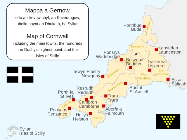
| Description | Map of Cornwall, the historic county; bilingual in Cornish and English | ||
| Date | |||
| Source |
This file is licensed under the Creative Commons Attribution-Share Alike 3.0 Unported licence. Attribution: Wikishire
|
||
| Author | Hogweard | ||
| Permission (Reusing this file) |
|
||
| Other versions | CornwallKernowMappa.png |
File history
Click on a date/time to view the file as it appeared at that time.
| Date/Time | Thumbnail | Dimensions | User | Comment | |
|---|---|---|---|---|---|
| current | 07:54, 3 September 2023 | | 1,120 × 840 (1.71 MB) | wikimediacommons>Hogweard | {{Information |Description=Map of Cornwall, the historic county; bilingual in Cornish and English |Source={{Wikishire data}} |Date=2023-09-03 |Author={{u|Hogwerad}} |Permission={{PD-self}} |other_versions={{f|CornwallKernowMappa.png}} }} Category:Maps of Cornwall |
File usage
The following 2 pages use this file:
